 |
| Dora |
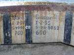
Cäsar |
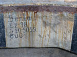
Berta |
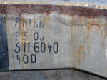
Anton |
| E-2-97 |
E-2-95 |
E-2-98 |
F 3 05 |
| S-49-80 |
S-46-5052 |
S-20-5059 |
S 11-6040 |
| 700 |
600 |
600 |
400 |
|
|
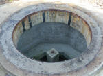
Inside a heavy MG stand, Wn 220H, De
Punt, Goeree, NL, 11-2012 |
|
 |
 |
 |
|
Firing directions for the MG: Several sectors indicated
with names, I can only guess the rest: E indicating the
'Entfernung' and S indicating 'Strich'? |
| A circle with a
radius of a 1000m has an outline of 6280m, the next round number
was taken: 0 or 6400 'Strich' to be the North. The distance to a
goal is: the dimensions of the object * 1000 * ... 'Strich', for
more info visit
this link. |
|
 |
 |
Again
several angles |
|
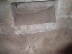
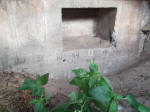
Inside a S449, Stp. Roland I, Römö,
DK, 08-2010 |
|
photo's: JP |
|
 |
 |
 |
|
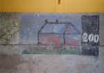
Firing directions inside a H69 Mortar/MGTobruk, Wn 10,
Dunes De Varreville, Utah beach, F, 08-2012 |
|
photo's: AT |
|
 |
 |
 |
|
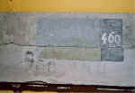
Coming
from an unknown bunkertype, Utah beach museum, Normandy, F, 06-2004 |
|
 |
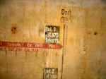 |
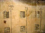
different landmarks
and data |
|
Inside
a Michelmannstand somewhere on the AW |
|
photo's:
PF
|
|
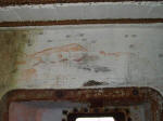 |
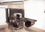
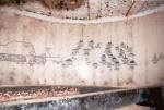
The complete line of
fire with all relevant landmarks with distances. |
|
Inside
a Vf PAK-bunker south of Stavanger, N |
photo: EE |
|
 |
 |
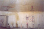
The complete line of fire
with all relevant landmarks with distances and angles. |
| Inside a gunbunker for a 10.5 cm gun St. Helier, Jersey, C.I., G.B., 05-1997 |
|
 |
 |
 |
|
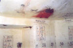
Inside a 'FL 243 Schwere Flakstellung' on Fano
near Esbjerg, DK |
photo: MS |
|
 |
update, photo: TH |
 |
 |
 |
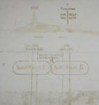
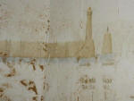
Fixed targets inside
a bunker on Pen Bron near St. Nazaire, Brittany, F
|
|
photo's: MV |
|
| Pumpenhaus |
| Strasse |
| Friedhof |
|
Sperr.f.
Raum IJ |
|
Sperr.f.
Raum II |
|
|
Seezeichen,
the beacon |
| Leuchtturm,
the lighthouse |
| the
beacon: distance (Entf) 1400m, the sector (Teilb) is 5610 Strich |
| the
lighthouse: Entf. 950m, Teilb. is 5560 Strich |
|
|
Treppe |
| Kloster |
| Steinklippe |
|
 |
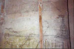 |
nice
churchtower at 2550 m., house at 1720 m. and a light-house at 1675 m. |
|
Inside a 'R 612
Schartenstand für Lande- und Sturmabwehrgeschütze', Franceville la Redoute, F |
|
photo's: PT |
|
 |
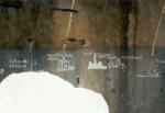 |
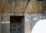
The
complete line of fire with all relevant landmarks with distances (repainted after the
originals) |
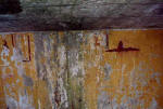
| Inside the
tobruk battle-headquarters 'R 608 Batl.-, Abt., oder Reg.- Gefechtsstand', W.N. 17
, Colleville, Normandy, F, 08-2001 |
|
 |
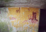 |
<= a
long time disappeared beacon on the seafront
shape of the Etel semaphore demolished 1945 => |
|
Inside a 81 mm mortar
tobruk, Etel near Lorient, Brittany, F, 07-2001 |
|
photo's: PLL |
|
 |
 |
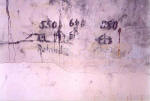 |
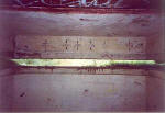
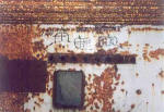
| Inside
a measuring post 'S 449', MG-bunker 'R 681, top of a AA-bunker 'L
410A' and again the 'S 449' Rømø, DK |
| photo's:
MS |
|
|
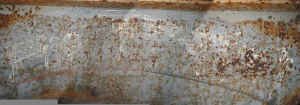
240 260 280 300 320 340 |
120 ... 200 ... 300 (?) |
550 ... 640 ... 380 |
 |
click
here for a reconstruction of the war-time view of the harbour
of
Lorient including the UBB as seen from the bunker |
|
Inside
a machinegunbunker R-630, Dönitz's H.Q., Kernevel, Lorient, F,
07-2004 |
|
 |
 |
|
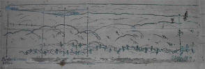
Inside 671 SK's, M.K.B. 'Vineta' 4*15 cm
(Stp. III M.), 'Festung Hoek van Holland', NL, 01-2001 and 03-2002 |
photo's:
AvB and author |
|
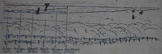
| Bunkereingang
80m |
| Straßenknick
120m |
| Panzerm.
260m |
| Juliane
1250m |
| Gunbunker 2 right |
|
|
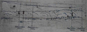
Panzermauer 300 m |
|
Südmole 2650 m |
|
Nordmole 2200 m |
|
Schornstein 184 m |
|
Panzerm. 180 |
|
Gunbunker 2 left |
|
 |
 |
|
Bunker Nordmole 415 m |
|
Südmole === m 2630 m |
|
Panzerm. 115 m |
|
Nordmole 2180 m |
|
Drahtvernau 60 m |
|
Schornstein 170 m |
| Gunbunker 3 left |
|
|
Weg 70 m |
|
Straße 180 m |
|
Mast Juliane 1270 m |
|
Drahtvernau 190 m |
|
Gunbunker 3 right |
|
 |
 |
|
Bunker 470 m |
| Panzerm.
324 m |
| Südmole
2850 m |
| Straße 120
m |
| Panzerm.
200 m |
| Nordmole
2150 m |
| Gunbunker 4 left |
|
| Drahtvernau
195 m |
| Mast
Juliane 1270 m |
| Straßeknick
260 m |
| Gunbunker
4 right |
|
 |
| WC 440 m |
| Mu ? 1050
m 22' |
| Strohdachh.
510 m |
| Kmdr.
Haus 660 m 29' |
| Haus
Distal 830 m |
| Ziegelst.
? 35' |
| Feldpost
600 m 37' |
| Turm Monster 5100 41' |
|
inside
two 'R 612's Schartenstand für Lande- und Stürmabwehr-
geschütze ohne Nebenräume' of the same complex, 03-2002
|
|
 |
| Mülde
2000 m |
| Zahnstation
380 m |
| Kirchhofverw.
590 m |
| Wache
320 m |
| Wehrmachtheim
980 m |
| Häuser
960 m |
| ? |
|
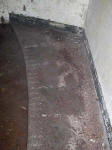 |
painted on the floor the
angles of fire, same complex as above |
 |
|
open
gun emplacement Batt. Merville, Normandy, F
|
|
photo:
BJ |
|
| an other
example |
 |
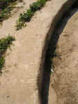
this
is the aiming circle for the gun. A total of 9 plates with each 40 marks
makes a total of 360 degrees. Navy directions. |
|
open
gun emplacement M 158, Granville, F, 08-2003 |
|
photo:
LvdW |
|


